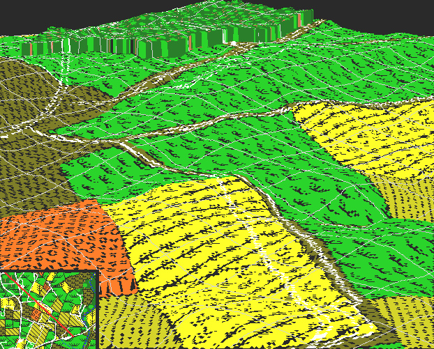
This aerial 3D image is along the same line of sight as the previous image , looking in the opposite direction, ie northwest. The West Woods are in the distance, the Dunker Church just visible in the center of the image. Moving clockwise, the roads radiating from the left are the Hagerstown Turnpike, Mumma's lane, and the Sunken Road. The Smoketown road can just barely be made out at the upper right, as can Roulette's lane near the center right. An orientation map is provided in the lower left; the view is from the southeastern end of the line, looking northwest.