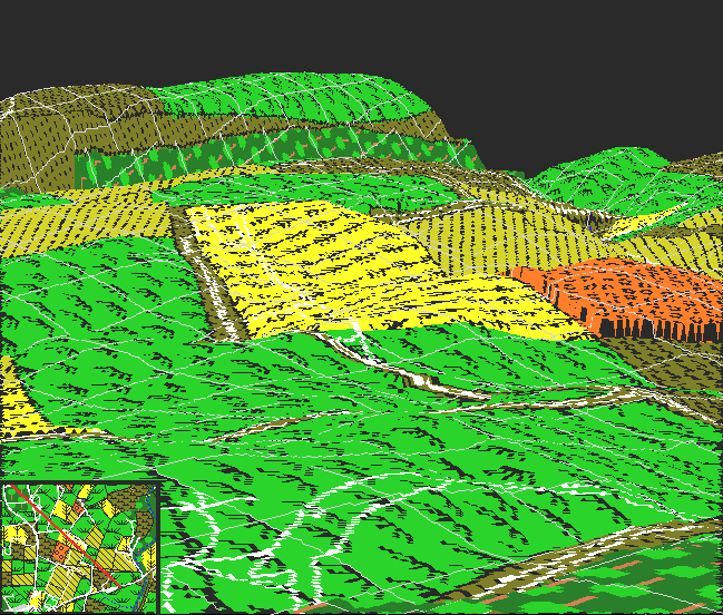
This image depicts an aerial 3D image of the Sunken Road region, from a position above the West Woods looking southeast. Piper's cornfield dominates the center of the image, with his orchard off to the right. The eastern portion of the road is seen almost edge on. An orientation map is provided in the lower right; the view is from the northwest end of the line, looking southeast.
The way Kimball's Knoll shields the 'angle' of the road is even more apparent here. Notice how Roulette's lane is completely hidden. It is not hard to imagine how the Confederates could thrust counter attacks up this corridor with the ground providing protection of its flanks.
In the distance, a portion of the high ground on the east side of the Antietam can be seen. Visible here is the ground just south of the Middle Bridge, the region occupied by Taft's and von Kleiser's batteries.