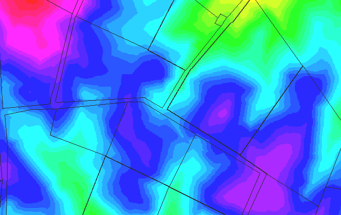
This image shows the elevation contours of the Sunken Road region. Red indicates the highest elevations; blue, green, and yellow shades indicate lesser elevations, respectively. An outline of wartime fences and landuse boundaries are provided for orientation.
From this image, the easiest route to the Sunken Road is against the western portion in a southward direction from the region where the visitor's center is located; this route is more or less downhill. The eastern portion of the road is much better protected, since the assault has to come over a ridge instead of downhill. An assault southward against the western portion of the road, however, would leave the union right flank exposed to the Confederate troops west of the Hagerstown Turnpike.
In summary, the Sunken Road position is more than just a trench, but also a series of hills and ridges that help to protect and shield defenders against attacks against either portion of the road.