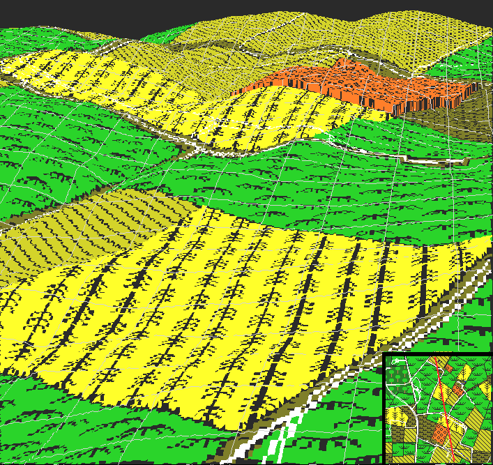
This image shows an aerial 3D view of the Sunken Road region from the vicinity of the Mumma farm, looking southward. Piper's cornfield and orchard run along the top of the image; The Sunken Road runs diagonally below Piper's corn, and then cuts across to the right. An orientation map is shown in the lower right; the view is from the north end of the line looking south.
As can be seen from this point of view, the rise of ground known as Kimball's Knoll (near where the road bends) forms a boomerang shaped obstacle which limits visibility from both sides.
The rise of the ground east of Roulette's lane (to the left in this image) does the same thing for Anderson's portion of the road. Troops have to be real close before they can see each other.
When visiting the battlefield, the trench-like nature of the Sunken Road is obviously apparent. What is often overlooked is the way the terrain between the road and the Union's approaches provides a shield which keeps both sides out of sight until they are right on top of each other.