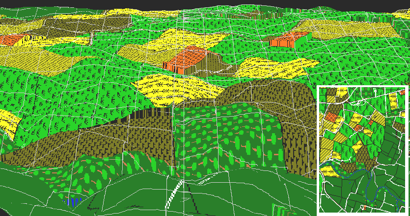
This image shows a computer simulation of an aerial view from the direction of the Pry House. The three orchards visible are (from left to right) the Piper Orchard, the Roulette Orchard, and the Mumma Orchard. On the extreme right side of the view is a small portion of the East Woods. Directly in the center, barely visible is the West Woods. The east-west portion of the Sunken Road (which intersects with the Hagerstown Turnpike) is visible head-on, just to the right of the cornfield, which is, in turn, just to the right of the Piper Orchard. An orientation map is provided in the lower right corner.
This view is from a point a few hundred meters above the high ground along the east bank of the Antietam. The West Woods are almost completely obscured by the rise in the ground just east of the Dunker Church (the same ridge where S. D. Lee's Artillery was first positioned, and where the Visitor Center is now located). From a position closer to the ground (ie, the view actually available to General McClellan at the Pry House), the West Woods would completely disappear behind this ridge.
In the same way that the West Woods are blocked by the rise just in front of them, the rise in the ground in front of the northwest-southeast portion of the Sunken Road blocks this important scene from McClellan's view. Like Sedgwick's troops disappearing out of view as they approached the West Woods, Richardson's First Division would also disappear from view just as they engaged the Confederate position in the Sunken Road.
Overall, it should be clear that the view from the Pry House is poor, lacking line of sight of critical positions on the battlefield.