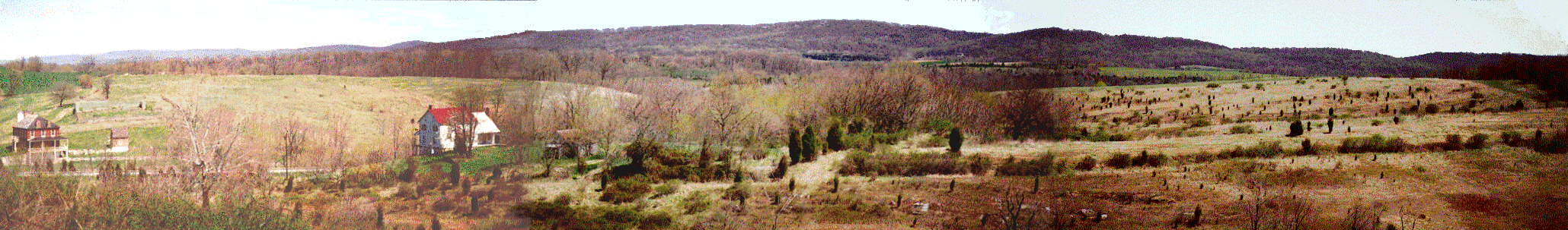
This panoramic view of the Otto Farm is taken from the high ground above Otto's plowed field. On the left is the Sherrick house; the Otto House is to its right. Toward the middle and right of the image is what was Otto's plowed field, although now it is now scraggly underbrush. Although this position dominates the ground below, it is not the actual high ground of the region; the ground climbs even higher west of here, toward Sharpsburg.
In addition to the advantage of height over the fields below, a stone wall ran along the crest of this ridge to further aid the defenders. If properly supported, the action here could have foretold Marye's Heights in Fredricksburg, where waves of Union attackers charged a stone-fence lined hill. Since the Confederates were totally outnumbered, however, they did not even bother to try to defend this stone wall, except near its southern end, where it looks over Otto's 40 Acre Cornfield.
Later in the day, after the Federals retreated back to the creek, the Confederates took up their final line along this ridge. They held this ground until Lee's army withdrew into Virginia, on the night of the 18th.
All the ground to the right of the Otto farm house is private land, and unaccessible to the public, despite the fact that there are monuments down there. Until recently, the only part of the Park which covered this final phase of the battle was the thin strip of land on which Branch Avenue runs (and another thin strip for the footpath to Hawkin's Zouaves Monument). A large piece of land between Branch Avenue and the Harper's Ferry road was recently acquired, although this still does not include any of Otto's fields, nor the 40 acre cornfield.