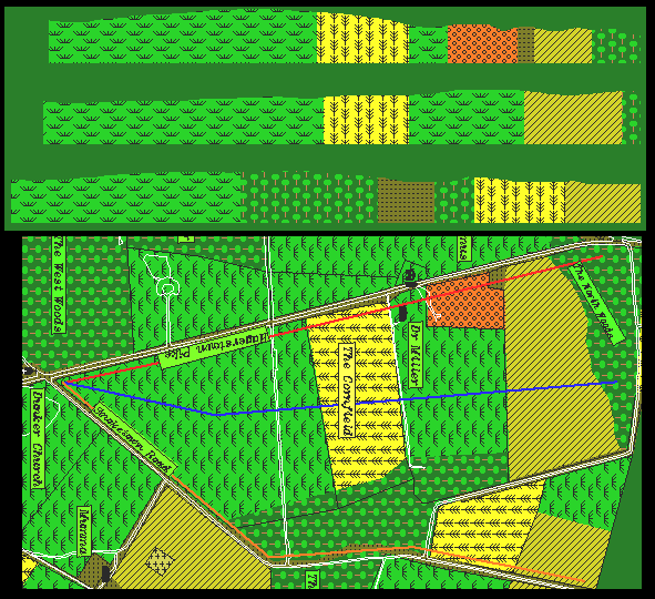
These profile views show the changes in elevation along three paths of advance from the initial Union line to the Dunker Church. The top profile corresponds to the path indicated by the red line on the map, the middle profile by the blue line, and the bottom profile by the orange line. All three profiles are drawn the the same vertical and horizontal scale.
It can be seen that the red path, parallel to the Hagerstown turnpike, is by far the roughest route. By comparison, the blue line is much flatter, but tends to maintain an overall higher elevation until the vicinity of the Cornfield. As is also visible in the 3-D aerial view, the Cornfield is not flat, the western portion having a higher elevation and climbing slope as opposed to the central region which is fairly level. The large bulge just south of the Cornfield on the red path is not present on the blue path.
The orange path is somewhat rougher and longer than the blue path. The high ground along this path is near where it exits from the East Woods. From there, it is a gentle slope down to the Dunker Church.