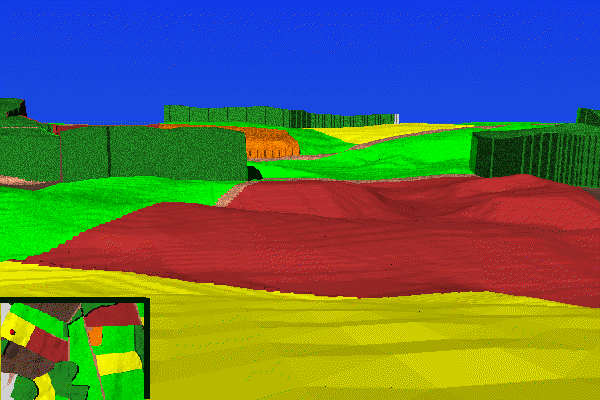
This image shows a computer simulation of the view from Nicodemus Heights down onto the Miller farm. The North Woods are at the left. The Cornfield is in the distance, a little right of center. The northern portion of the West Woods is at the middle right. The view is looking a little south of west; an orientation map is provided at the lower left of the image. The red dot shows the point from which the view was made. This point represents the optimal view of the Miller farm from Nicodemus Heights. For an explanation of how this optimal point of view was determined, see Line of Sight From Nicodemus Hill.
This would be the approximate view of the Confederate horse artillery at the opening phase of the battle. As the Union assault emerged from the North Woods headed south (to the right in this image), their line was hit by enfilade fire from this position.
Although often cited as a key position on the battlefield, the field of view from atop Nicodemus Heights was limited. While it did offer the opportunity for enfilade fire on Union troops north of the Cornfield, as the action moved into and south of the Cornfield, this was no longer an effective artillery position.