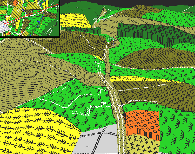
This image illustrates the view looking northeastward from Sharpsburg. The Boonsboro turnpike runs from the bottom to the top of the image. At the bottom of the image, just to the right of the turnpike is the Lutheran Cemetery.
The midground of this image is dominated by Cemetery Hill. Note that Cemetery Hill includes ground on both sides of the turnpike. The portion of the hill south of the turnpike (to the right, shown in this image as a stubble field) is now occupied by Antietam National Cemetery; the modern road from Route 34 to the center of the cemetery is the footpath that leads to "Old Simon" - the 44 foot monument of a private soldier. The northern portion of the hill (to the left) is occupied by Mountain View Cemetery (established in 1883). The plowed field to the left of the turnpike marks the high ground on the Piper farm. Together, these two hills - Cemetery Hill and the Piper farm hill - form an excellent defensive position to resist an advance up the turnpike.