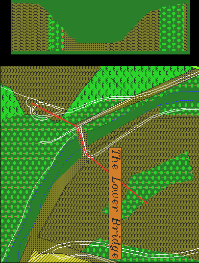
This image shows a profile, or cross-section view of the elevation changes encountered by Union troops ( the 11th Connecticut, Nagle's Brigade, and the 51th Pennsylvania) attempting to reach the bridge, cross to the other side, and climb the ridge held by the Confederates - as indicated by the red line.
As one can see, from the stubble field (moving right to left in the image), the ground gently drops as the path crosses into the woods until it reaches the stubble field again, where the ground begins to drop off dramatically. Upon reaching the bridge level, the total elevation drop is 84 meters, over a distance of 180 meters.
On the other side of the bridge, the climb to the crest is even steeper, having about the same rise in elevation, but over a shorter distance. Fortunately for the Union, Confederate resistance ceased when the bridge was crossed, avoiding what might have been an extremely difficult advance up the slope. Low on ammunition, and flanked by Union troops that had finally found fords downstream on the south, the Confederates fled eastward where they took up a line along a stone fence on the west face of the 40 acre cornfield.