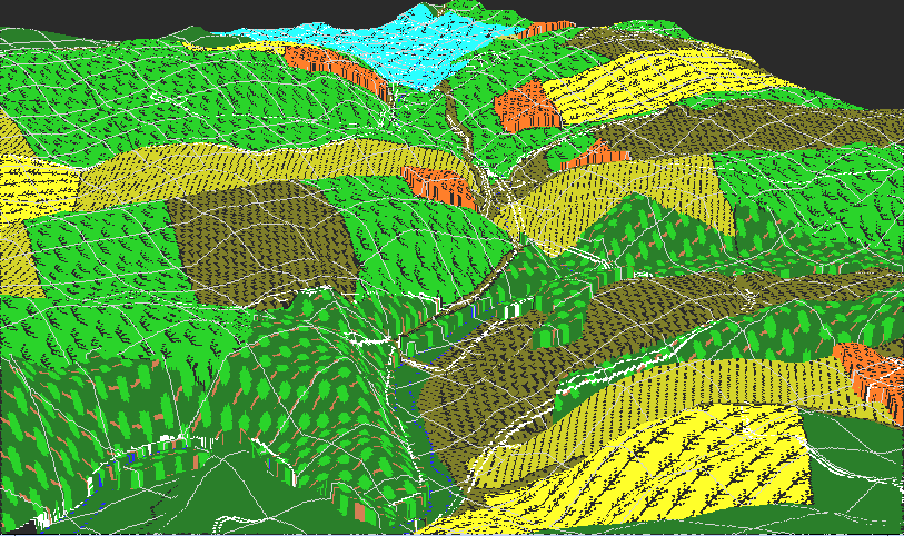
This view shows the terrain in the vicinity of the Lower Bridge. The bridge itself is visible at the center, about a third up from the bottom (where the white line crosses the creek). The bluish region in the background marks the position of the town of Sharpsburg. The orchard closest to the center of the image is that of the Otto farm. The cornfield at the left center is the northern portion of the 40 acre cornfield.
This region is the roughest portion of the battlefield. The steep hillside on the Confederate side of the creek completely dominates the open stubble field Union troops had to cross to get to the bridge, or to any point along the bank of the creek for that matter. If Lee had sufficient troops to defend this position properly, the action here would have presaged Fredricksburg. As it was, only the barest of force defended here, the rest having been stripped away to the Confederate left near the West Woods.