 Since Otto's 40 acre cornfield is on private property,
few visitors to the Antietam National Battlefield have had
the opportunity to see this scene.
Since Otto's 40 acre cornfield is on private property,
few visitors to the Antietam National Battlefield have had
the opportunity to see this scene.
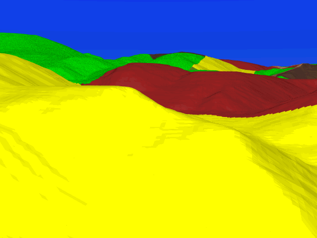
We are standing on one of the high points Otto's 40 Acre Cornfield, looking northward directly toward Cemetery Hill; the cornfield which stretches across Cemetery Hill's eastern side and the stubble field on its crest are clearly visible. In the distance, on the far left of the image is Hawkins' Monument Hill, the high ground which marks the point of the Union's farthest advance.
The 16th Connecticut, followed by the 4th Rhode Island, advanced into "a deep valley between two hills planted with corn". That valley is at the bottom of this view, formed by the hill we are standing on and the hill in the immediate foreground (the aforementioned two hills). Having advanced into this valley these two regiments got cut off from the rest of the Union line, opening a gap which was exploited by A.P. Hill's Confederate reenforcements.
As Union troops in this cornfield were driven back eastward toward the Antietam Creek (to the right), the entire Union line was obligated to retreat likewise. By nightfall, all Union troops had evacuated all the ground in this image.