 From this position on the southern slope of Cemetery Hill, we are looking
toward the Otto Farm.
Sherrick's orchard is in the lower left of the image,
and the Lower Bridge Road cuts across the lower left corner.
Otto's plowed field is in the distance, and the 40 acre cornfield
is just visible a little right of center.
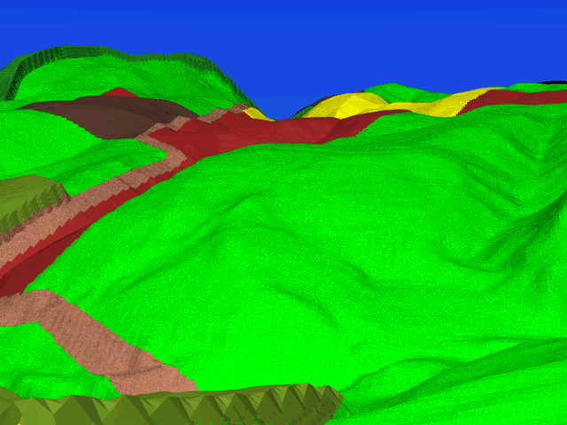
From this position on the southern slope of Cemetery Hill, we are looking
toward the Otto Farm.
Sherrick's orchard is in the lower left of the image,
and the Lower Bridge Road cuts across the lower left corner.
Otto's plowed field is in the distance, and the 40 acre cornfield
is just visible a little right of center.
Directly in the center, on the rise on the other side of the Lower Bridge Road, is the site of what is now known as Tour Stop 10, "The Final Attack". Branch Avenue, which now curves up this slope, is not in the image as there is no wartime counterpart of this modern road.
From this vantage point, one begins to get an appreciation of the magnitude of the task assigned to the Union IX corps. The ground here is quite challenging. The region of the 40 acre cornfield where left flank of the IX corps (the 16th CT and the 4th RI) got hung up is where the cornfield dips out of view.
Despite the great difficulty that the ground presented, the Federal advance made considerable progress, until Confederate reenforcements arrived to turn the tables.