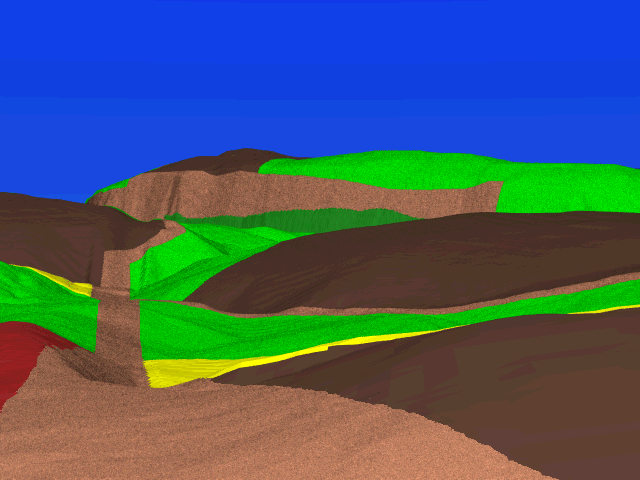
 From this position, we are standing on top of Cemetery Hill, looking
northeast down the Boonsboro Turnpike.
The stubble field to our right is now occupied by the National Cemetery.
In the midground on the right we can see Sherrick's stubble field,
with Sherrick's lane running in front of it.
Note how the Turnpike jogs around to the right of the stubble field-capped
hill in the distance.
The modern road runs through a cut in the hill, and the side road is now
the site of the Antietam picnic area.
From this position, we are standing on top of Cemetery Hill, looking
northeast down the Boonsboro Turnpike.
The stubble field to our right is now occupied by the National Cemetery.
In the midground on the right we can see Sherrick's stubble field,
with Sherrick's lane running in front of it.
Note how the Turnpike jogs around to the right of the stubble field-capped
hill in the distance.
The modern road runs through a cut in the hill, and the side road is now
the site of the Antietam picnic area.
It can't be seen properly from here, but the Sunken Road intersects with the Boonsboro Turnpike along the far edge of the distant cornfield on the left. The Sunken Road skirts to the northeast of a deep depression which can be seen as it snakes to the right of what is now the picnic area.
Despite the hill's fantastic vista, you can't see the Middle Bridge from here: it lies behind the stubble field-capped hill. Federal troops massing on the Newcomer farm at the Middle Bridge therefore had some degree of cover from Confederate observers on and north of the turnpike.