 This image was generated from a corn-topped hill on the Roulette farm,
looking northwestward toward the Mumma farm.
Roulette's lane runs along the bottom of the image.
The Mumma orchard is directly ahead,
with the Mumma cemetery just beyond the orchard.
The southern face of the East Woods are on the horizon on the right.
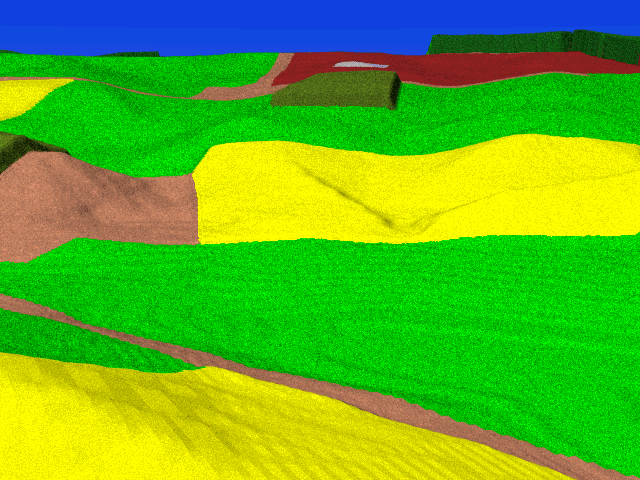
This image was generated from a corn-topped hill on the Roulette farm,
looking northwestward toward the Mumma farm.
Roulette's lane runs along the bottom of the image.
The Mumma orchard is directly ahead,
with the Mumma cemetery just beyond the orchard.
The southern face of the East Woods are on the horizon on the right.
This region served as a staging area for Union troops approaching the Sunken Road. Both French's and Richardson's brigades moved right to left on either side of Roulette's lane toward the Sunken Road.
Although we are looking directly in the direction of the Miller Cornfield, neither it nor the North Woods are visible. Even though this view is from a hill, we are still inside Mumma's Swale and effectively cut off from the northern portion of the battlefield.
This view offers a rare glimpse of this region of the battlefield, not ordinarily accessible to the visitor, since it is on private land.