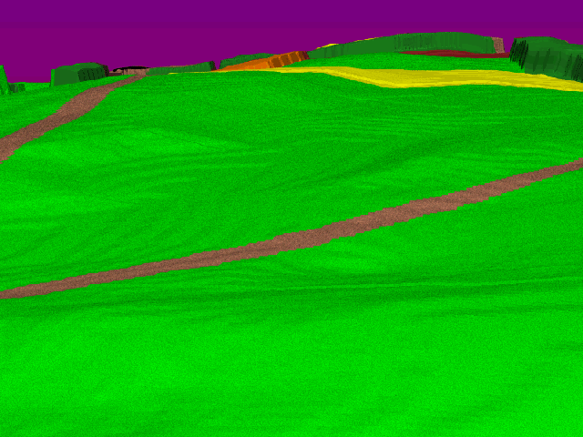
 This image depicts the view looking north from the high ground just
east of the Dunker Church.
The Smoketown Road sweeps across the view from left to right, and
the Hagerstown Road runs off to the distance on the upper left
of the image.
The East Woods can be made out on the upper right, and the North
Woods run across the background.
The famous Miller cornfield stretches across the ground in the distance.
This image depicts the view looking north from the high ground just
east of the Dunker Church.
The Smoketown Road sweeps across the view from left to right, and
the Hagerstown Road runs off to the distance on the upper left
of the image.
The East Woods can be made out on the upper right, and the North
Woods run across the background.
The famous Miller cornfield stretches across the ground in the distance.
This is the position occupied by S.D. Lee's artillery during the northern phase of the battle. As can be seen, the position dominates the all approaches from the north, including both major roads.
This view was captured by Gardner's camera shortly after the battle (see View 2 of the Dunker Church). No other location on the northern portion of the battlefield offers such a commanding position.
A visitor to the battlefield today can stand in this spot, but the North and East Woods are gone, and a large post-war farm occupies the large bulge on the left midground.